

I found this great map. It’s available on the Santa Monica digital library.
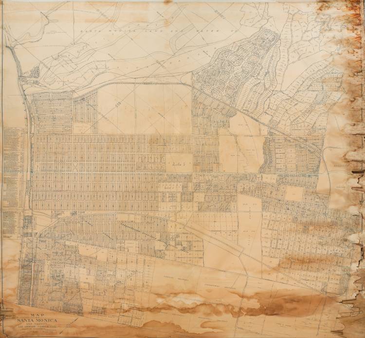
The map itself has amazing detail. It also covers the entire length of the Westgate Line, a trolley service once operated by the Los Angeles Pacific Railway. The Westgate branch used to travel along San Vicente Boulevard, branching off the Sawtelle line on Santa Monica Boulevard. The trolley route used to go straight north from the alley behind the Bank of America on Butler; then north through the ground of the VA campus, making a big arc westward through Brentwood and Santa Monica; finally turning south down Ocean Avenue back to Santa Monica Boulevard.
On the map, Wilshire Boulevard is still listed as Nevada Avenue. Santa Monica Boulevard is still Oregon Avenue, even all the way down through West LA. Pico Boulevard is still labelled Frémont Avenue! The neighboring town of Sawtelle is still named “Barrett,” and all its streets north-south streets are numbered, but east to west. It’s like Santa Monica’s evil twin — tee hee hee.
The map says it was compiled by William W. Phelps. I did a quick search on him and found him listed in 1909 in the The Journal of the American Society of Engineering Contractors, saying he served as the City Engineer for Port Huron, Michigan. Then, it says he was appointed City Engineer of Santa Monica in the January 6, 1912 edition of Engineering Record (Vol. 65).
The map is dated to 1910, so … not sure. Maybe he was the guy who tied together all the surveys from the previous two years?
Interestingly, this Mr. Phelps’ map seems to follow on the heels of Pacific Electric’s “Great Merger” of 1911.
