Flood Maps Show Venice Underwater

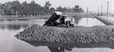
Venice of America canals being filled in.

Venice was once a swamp.

That’s just its history. It, and the adjoining Marina del Rey area, were collectively a swampy marsh area that was converted into waterways. When oil was discovered, and cars became more important than gondolas, much of the canal network as filled back in to make roadways.
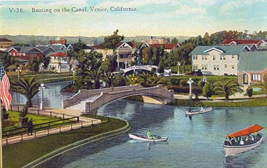
Early Canal Rendering

Now we have climate simulations that show us what the coastline would look like based on an increase in the mean sea-level elevation.

It doesn’t look good for Venice and the Marina. If you raise the sea level over 17 meters, you can see what the future coastline will look like.

If I were Lex Luthor, I’d buy land in Mar Vista.

Here are the area’s Flood Maps.

I Prefer Paris: Courtyard Week: 41 rue Jussieu & 28 bis rue Cardinal Lemoine

I Prefer Paris: Courtyard Week

Insane Stone Carving Works

What’s that? Oh, don’t worry about it. It’s just a little post on sixteenth century Parisian architecture. No biggie.

What is it about this stuff? It’s beautiful, but there’s more to it than that. I’ve seen imitation renderings of this stuff in faux-revival homes in Bel Air. And I’ve seen the real deal at San Simeon and the Getty Villa. No, something about seeing the original work in its original location gives it its gravitas.

See the beautiful courtyard at 41 rue Jussieu & 28 bis rue Cardinal Lemoine in Paris.